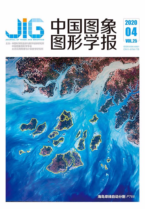
改进Deeplab网络的遥感影像海岛岸线分割
摘 要
目的 海岛作为一项特殊资源,在海洋开发和利用方面发挥着重要的作用;遥感作为一种非接触式远距离探测手段,为海岛研究提供了重要的数据来源;而深度学习因其对图像特征的提取能力和对复杂问题的拟合能力广泛应用于各个领域。本文结合深度学习的计算优势,兼顾遥感影像的波段数量多和覆盖范围大的特征,以海岛岸线的快速分割为目的,提出了一种改进的海岛岸线遥感影像分割模型。方法 该分割模型包括3方面:1)针对遥感影像的多波段特征,提出基于最佳指数的遥感影像波段组合选择,将选择后的波段组合作为海岛岸线分割模型的输入数据;2)针对遥感影像大范围覆盖的特征,提出基于Deeplab神经网络结构的海岛岸线粗分割,将粗分割结果作为海岛岸线优化的初始边界;3)利用全连接条件随机场优化海岛岸线,实现海岛岸线的细分割提取。结果 以大小不等的4个海岛的岸线提取为例,分别采用改进的海岛岸线分割模型、全卷积神经网络模型(fully convolutional networks,FCN)、Deeplab模型和目视解译法从遥感影像数据中分割海岛岸线。同时,引入平均交并比(mean intersection over union,MIoU)和相对误差,对各模型分割的海岛岸线结果进行精度比较。结果表明,本文改进的海岛岸线分割模型克服了FCN模型海岛岸线的不连续性问题,降低了海岛岸线的误分割现象;从MIoU值的比较可以看出,本文改进模型与目视解译的海岛岸线结果具有更高的吻合度,较FCN模型提高了17.7%,较Deeplab模型提高了5.2%;从海岸岸线的周长和面积的相对误差可以看出,本文改进模型的相对误差均低于FCN模型和Deeplab模型。结论 本文改进模型包含了面向遥感影像的波段选择、利用神经网络训练的海岛岸线粗分割和基于全连接条件随机场的海岛岸线优化,在保证岸线连续性的前提下,提高了海岛岸线的分割精度。
关键词
Island shoreline segmentation in remote sensing image based on improved Deeplab network
Wang Zhenhua, Zhong Yuanfu, He Wanwen, Qu Nianyi, Xu Lizhi, Zhang Wenping, Liu Zhixiang(College of Information, Shanghai Ocean University, Shanghai 201306, China) Abstract
Objective Island is naturally formed around the ocean and exposed the sea level at high tide. As a special resource, islands play an important role in ocean development and utilization. Most of the island shorelines were extracted based on the compared and analyzed historical charts, topographic maps, and field survey results, which had several shortcomings, such as difficult observation, high cost, and long period. As a noncontact detection method, remote sensing has become the most important data source for island research. In recent years, deep learning has been widely used in various fields because of its ability to extract image features and to fit complex problems. In this study, a novel segmentation method for island shoreline was proposed, which was designed by the optimum index factor (OIF), convolutional neural network model (CNN), and a fully connected conditional random field (CRF). Method The proposed method included three aspects:1) According to the multiband characteristics of the remote sensing, the optimal band combination was selected based on the OIF. OIF is defined as the ratio of standard deviation of the combined bands to the correlation coefficients of each band. In this study, taking Landsat-8 remote sensing image as data source, the spectral characteristic information of each band of the image was analyzed based on OIF, and then 1,5, and 6 bands were selected as the optimal band combination, which is considered as the input data for the island shoreline segmentation.2) According to the large coverage characteristics of the remote sensing, a deep convolution neural network model, Deeplab, was selected to obtain essential features of the input image. In general, segmentation methods extracted the characteristics of training samples relying on the artificial experiences, and a single-layer feature, without a hierarchical structure, was obtained by learning. These methods could supply shallow structures and simple features. This condition is the inadequacy of island shoreline segmentation. Thus, given that Deep CNN architecture has the ability to effectively encode spectral and spatial information, it had quickly become the prominent tool in remote sensing applications. Here, the representative deep CNN architecture and Deeplab neural network were selected. Deeplab neural network consists of three parts:(1) ResNet-101 residual network, which is used as the backbone network to the high-dimensional characteristics of remote sensing images. Residual learning can reduce the burden of deep network training, reduce the phenomenon of gradient disappearance caused by several layers, and improve the training accuracy. (2) Dilated convolution in Deeplab neural network, which can aggregate multiscale contextual information without losing resolution or analyzing rescaled images, increase the performance of dense prediction architectures by aggregating multiscale contextual information. (3) Deeplab neural network, which includes aurous spatial pyramid pooling (ASPP) module. It uses dilated convolution with different sampling rates and can effectively capture multiscale information of island images. 3) The island shoreline was optimized by the fully connected conditional random field. As an excellent representative of a probabilistic graphical model, the fully connected conditional random field can incorporate the spatial contextual information in the aspects of labels and observed data. The uniqueness of this model is that it can be flexible to modeling posterior distribution directly. We pre-classify the entire remote sending image into certain island shoreline types via the Deeplab model by using the results of class membership probabilities as the unary potential in the CRF model. The pairwise potential of CRF is defined by a linear combination of Gaussian kernels, which form a fully connected neighbor structure instead of the common four-neighbor or eight-neighbor structure. We use the mean field approximation method to obtain super pixels and correct the classification results by calculating their average posterior probabilities. Result Taking four different islands as example, the island shorelines were segmented by the proposed method, full convolutional neural network (FCN) model, Deeplab model, and the visual interpretation method. Taking the relative error of area and perimeter of the island and the mean intersection over union (MIoU) as the accuracy parameters, the shoreline segmentation results of the four islands were compared. In addition, the relative error of area and perimeter of the proposed method (perimeter) are reduced by 4.6% and 17.7%, respectively. MIoU of the proposed method is increased by 5.2%. Conclusion The comparison results showed that the proposed method overcomes the shortcomings of the traditional segmentation methods for island shoreline segmentation, and it takes full use of the band information of the remote sensing images.
Keywords
island shoreline image segmentation deep learning optimum index factor Deeplab neural network fully connected conditional random fields
|


 中国图象图形学报 │ 京ICP备05080539号-4 │ 本系统由